| |
[Outline of Concept for the:]
African Historical Graphics Archive
Copyright © 2018, 2022, Timothy C. Weiskel
| The African Historical Graphics Archive
is designed to record, conserve and present historical maps and
graphic images of Africa and its peoples for advanced scholarship,
public exhibition and curriculum development on African history
throughout the world.
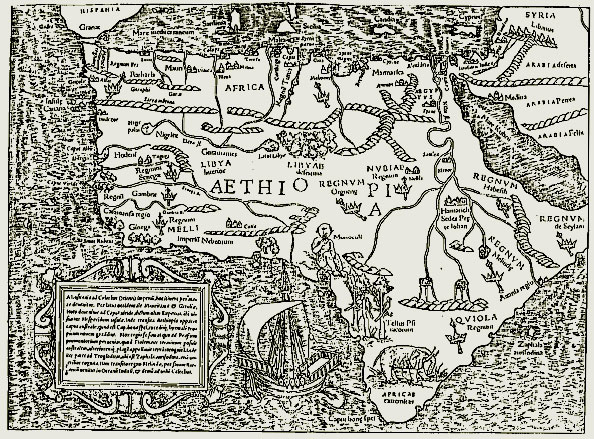
Maps
of Africa and graphic images of its scenery and peoples have been
produced by North Africans and Europeans ever since the work of medieval
Arab geographers and the earliest contacts of the Portuguese with the
West African trading kingdoms in the fifteenth century. While numerous
European and American libraries and archives have rich repositories of
this material for particular regions of Africa, no systematic effort has
yet been made to collect, catalogue, interpret and present this
material for in-depth historical scholarship, teaching and broader
public appreciation.
Until
recently undertaking such a massive task was virtually impossible.
Individual collections of rich material are so dispersed and the
historical and linguistic expertise required to deal with each
collection is so varied that it seemed impossible for an individual
scholar to accomplish the work necessary even to begin such a project in
a single life-time.
Within
the last decade, however, the emergence of computerized imaging
technology and the associated development of online visual database
software now makes it possible to build a new kind of international
research facility that can coordinate and administer a multicultural,
cooperative, and cumulative research project to identify, catalogue,
preserve and present these priceless historical images of Africa to
scholars, educators and the public at large both in America, Africa and
throughout the world.
The
urgency for beginning this work stems from the fragile and
deteriorating nature of the documents themselves. The paper upon which
maps and images of Africa have been printed is in serious danger of
deteriorating beyond retrieval. Unless a deliberate effort is made in a
timely fashion to arrest the deterioration and engage in purposive
restoration, many of the earliest and most valuable maps and images will
be lost forever.
Image
capturing and reproduction technology make it possible to replicate the
graphic images and digitally preserve them to retrieve the priceless
information they contain before the originals become totally unusable. A
systematic program of document recovery and restoration of this nature
can be designed to serve the needs of the international scholarly
community and make these invaluable primary materials available for
in-depth analysis, public exhibition and distribution to participating
institutions throughout the United States and around the world.
From
an ever expanding core of digitized documents provided by participating
institutions scholars will be able to assemble and curate collections
of selected original graphic material for their particular needs as
part of their individual research projects. In coordination with
numerous emerging third-party technologies like those that have become
available through publicly accessible platforms including Google Earth, YouTube, Blurb and VoiceThread
participating scholars can develop and co-publish important new studies
in African history based upon this material. The interoperability of
the digital collection will make it both feasible and cost-effective to
produce digitally accessible textbooks, teaching materials and novel
curricula for use at all levels throughout educational systems
worldwide. (See, for example, "The Next Generation Of Maps" WBUR, Boston, 21 June 2012).
[For a brief and informal online presentation of some of the goals
and utility
of one of the Archive's projects see:]
|
|
|
|
| |
Potential Collaboration with Library and Museum Exhibits, Public Outreach
and Global Curricular Development |
| |
With tools developed from the basic map archives, it would be possible for professional historians from all disciplines and area specialties around the world to start developing multi-media teaching and research facilities. Consider, for example, how a "close reading" of African maps has already stimulated important ecological research and could enhance global research immensely. In fact, examining African maps and graphics closely can lead to a new understanding of global history.
The number of institutions and research centers that are developing their African maps and related historical material for public access is increasing each year. It is now possible, in principle, to create online links between these facilities. The African Historiccal Graphics Archives will devote speific attention to construct deliberate collaborative agreements with other distinguished online collections to highlight their strengths and provide increased awareness of their important resources. |
Potential Cooperating/Consortium Member Institutions |
| Institution |
Collection |
Title/Description |
| Library of Congress |
Library of Congress - Collections with Maps |
Online Maps of Africa |
| New York Public Library |
NYPL - Digital Collections |
The New York Public Library
Digital Collections.
Explore 899,199 items digitized from The New York Public Library's collections.
This site is a living database with new materials added every day, featuring prints, photographs, maps, manuscripts, streaming video, and more.
See particularly: Africa maps, West Africa Maps, South Africa Maps, East Africa Maps, North Africa Maps. You can try as well: Gold Coast, Senegal, Benin, etc. |
New York Public Library |
The NYPL Picture Collection Online – PCO |
The NYPL Picture Collection Online – PCO. The Picture Collection Online (PCO) is a select group of images from The New York Public Library, Mid-Manhattan Library, Picture Collection. Since its creation in 1915, the Picture Collection has met the needs of New York’s large community of artists, illustrators, designers, teachers, students, and general researchers. Covering over 12,000 subjects, the Picture Collection is an extensive circulating collection and reference archive, the largest of its kind in any public library system. See, example, the PCO holdings on: African history, slavery, slave ships and the slave trade.
|
| Yale University |
RAAI |
The James J. Ross Archive of African Images
A collaboration among the Yale University Art Gallery, the Yale
University Library and Yale alumnus James J. Ross, B.A. 1960, The Ross
Archive of African Images is a comprehensive database of images,
representing the majority of illustrations of African objects from
south of the Sahara published between 1590 and 1920 in books,
periodicals, catalogues, newspapers, and other publications. The
archive includes close to 5,000 images culled from public and private
collections, and sheds light on how objects were used in their
original contexts, such as ceremonies, shrines, village displays, and
day-to-day use. It allows scholars, students, and those seeking a visual
survey of African culture access to virtually every image publicly
available from 1590 to 1920, along with the original accompanying text,
providing an enlightening glimpse into the scholarship and attitudes
of the day. See: Ross Archive of African Images. |
| |
Yale Digital Collections |
Yale Digital Collections - Africa Maps
See individual entries of maps sorted by inverse chronological date or search by subject category, for example: Africa--Maps--Early works to 1800 |
| |
The Gilder Lehrman Center for the Study of Slavery, Resistance, and Abolition - GLC |
The Gilder Lehrman Center for the Study of Slavery, Resistance, and Abolition is part of the Whitney and Betty MacMillan Center for International and Area Studies at Yale University. Since its founding in 1998, the Gilder Lehrman Center has been dedicated to the investigation and dissemination of knowledge concerning slavery and its legacies across all borders and all time, from the distant past through the present day. |
| Harvard University |
Harvard WorldMap
Africa Map |
Mapping Africa...
Africamap is housed at the Center for Geographic
Analysis at Harvard University with an initial grant from the Harvard
Provosts Fund for Innovative Computing and ongoing support from the W.
E. B. Du Bois Institute, the Department of African and African
American Studies and the Committee for African Studies at Harvard
University. AfricaMap grew out of a project, called Baobab, funded by
the Seaver Institute. |
| Henry Lovejoy |
Slavery Images |
Slavery Images: A Visual Record of the African Slave Trade and Slave Life in the Early African Diaspora. |
| David Rumsey |
David Rumsey Map Collection |
David Rumsey Map Collection
The David Rumsey Map Collection was started over 25
years ago and contains more than 150,000 maps. The collection focuses
on rare 18th and 19th century maps of North and South America,
although it also has maps of the World, Asia, Africa, Europe, and
Oceania. The collection includes atlases, wall maps, globes, school
geographies, pocket maps, books of exploration, maritime charts, and a
variety of cartographic materials including pocket, wall, children's,
and manuscript maps. Items range in date from about 1700 to 1950s. |
| Stanford University |
Maps of Africa Online |
The Stanford Collection includes the Dr. Oscar I. Norwich’s collection of African maps is one of the more well-known private map collections. His collection consists of 316 maps from the 15th to the early 20th centuries, which he assembled over 40 years. Dr. Norwich wrote a comprehensive reference book on his set of maps titled Maps of Africa: an illustrated and annotated cartobibliography which was published in 1983 — this was followed by a second edition: Norwich's Maps of Africa published posthumously in 1997 by Terra Nova Press in Vermont and edited by Jeffrey Stone of the University of Aberdeen. Dr. Norwich also published two other books, A Johannesburg Album in 1986 based on postcards of early Johannesburg and Maps of Southern Africa in 1993. |
| The Afriterra Foundation |
Afriterra |
The Afriterra Foundation is a non-profit Cartographic Library and Archiveassembling and preserving the original rare maps of Africa in a definitive place for education and interpretation. Afriterra views cartography as a medium that uniquely links art, technology, and history, and it provides online searchable categories for its collection. |
| The University of Illinois |
Maps of Africa to 1900 |
The Maps of Africa to 1900 digital collection contains images of maps listed in the bibliography Maps of Africa to 1900: A Checklist of Maps in Atlases and Geographical Journals in the Collections of the University of Illinois, Urbana-Champaign (Bassett & Scheven, Urbana: Graduate School of Library and Information Science, 2000). As such, this collection mines not only the Library’s map collections, but also its extensive collection of 19th century atlases and geographical journals, including the Journal of the Royal Geographical Society (United Kingdom), the Bulletin de la Société de Géographie de Paris (France), and Petermanns Geographische Mittheilungen (Germany). |
| Northwestern University - Digital Collections |
16th-Early 20th Century Maps of Africa |
This collection features digital copies of 113 antique maps of Africa and accompanying text dating from the mid-16th Century to the early 20th Century. All scanned maps are authentic and originally collected by the Melville J. Herskovits Library of African Studies. Melville J. Herskovits established Northwestern University's Program of African Studies in 1948 (the first of its kind at a major research university in the United States). The Herskovits Library, formally created as a separate library in 1954, has since its inception collected maps that describe Africa from their earliest appearance to the most current. Map area coverage includes the continent, regions (particularly North Africa and Algeria), islands (particularly Madagascar), and a few city plans. All of these maps are loose items, though many have been excised from published atlases. Some of the highlights of the digital collection are: a series of Ptolemic maps of North Africa by Ruscelli, ca. 1565; Forlani: Africa , 1562; Mercator: Africa, 1595; Blaeu: Æthiopia ca. 1650 (a Prester John map); Carey: Africa, 1795 (first map of Africa published in the United States), Arrowsmith: Africa, 1802 (notable for its large dimensions, 124 x 145 cm.), a series of Algerian maps published by the French government in the mid-1800's, and maps by other notable cartographers, such as Hondius, Jansson, de Jode, de L'Isle, Ortelius, Sanson, and de Wit. The original maps are kept and maintained in the map collection in the Government & Geographic Information Collection. |
| DPLA (Digital Public Library of America) |
The Transatlantic Slave Trade |
Created by Frankie Abbott for DPLA (Digital Public Library of America), this primary sources set include documents, photographs, artwork, and maps that tell the story of the slave trade and its impact. Visit its ‘Additional resources’ and ‘Teaching Guide’ sections for more relevant resources as well as discussion questions or samples of class activities. |
| Emory University - Center for Digital Scholarship |
The Trans-Atlantic Slave Trade Database |
The Slave Trade Database comprises records of 36,000 individual slaving expeditions between 1514 and 1866 found in archives and libraries throughout the Atlantic world. They provide information about vessels, routes, and the people associated with them, both enslaved and enslavers. Sources are cited for every voyage included. Users may search for information about a specific voyage or group of voyages. The website provides full interactive capability to analyze the data and report results in the form of statistical tables, graphs, maps, a timeline, and an animation. |
| Brown University |
The Center for the Study of Slavery & Justice - CSSJ |
The Center for the Study of Slavery and Justice (CSSJ) at Brown University is a scholarly research center with a public humanities mission.
Recognizing that racial slavery was central to the historical formation of the Americas and the modern world, the CSSJ creates a space for the interdisciplinary study of the historical forms of slavery while also examining how these legacies continue to shape our contemporary world. |
|
|
|